Summary
The recent release of the following detailed geology data contains a geodatabase of feature classes of structure, surface and solid rock unit layers, as well as shapefiles and MapInfo tab files. As in the previous releases, symbology is represented in ESRI .lyr files and refer to the feature classes inside the geodatabase. In this release the .lyr files also include labelling. Further details on updates in this release are listed below.
For more information please refer to the detailed geology data index.
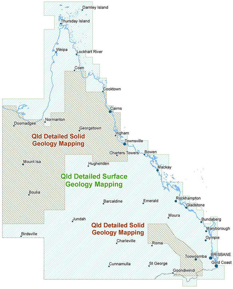
State-wide Detailed Geology Data Capture Project
Revised line ID descriptions for data extents
The state-wide detailed geology data has been assembled over time with data extents defined by generic line identifiers and descriptions e.g. Mapping Boundary - AGD66 (line ID’s 10 and 11), Mapping Boundary - GDA94 (line ID’s 12 and 13).
It was decided to revise and reassign line ID descriptions to make them more user friendly. There are some data mismatches due to different interpretations. It is hoped these mismatches will be resolved in future data releases (refer to Figure 1).
Revised ID description
10 - Extent of surface geology
11 - Mismatched surface geology related to different interpretations
12 - Extent of solid geology
13 - Extent of solid geology and mismatched surface geology related to different interpretations
Revised and new geology updates
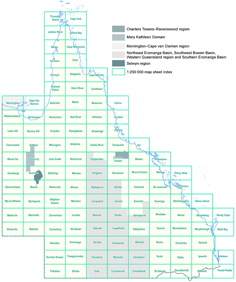
Capture Source, Capture Method and Capture Scale for the following updates are attributed data fields in the QLD_GEO_DETAILED_STRUCTURE_AUGUST_2022 release data(refer to Figure 2).
Mary Kathleen Domain
Coolullah (part), Prospector (part), Quamby (part), Mary Kathleen (part) Marraba (part) and Duchess (part) 1:100 000 map sheet areas.
This revision of the geology of the Mary Kathleen Domain and small parts of adjoining domains has resulted from recent fieldwork by the Geological Survey of Queensland (GSQ) and researchers at James Cook University. This work produced numerous new isotopic dates and an enlarged geochemical database, which combined with recently acquired, high-resolution geophysical images and reinterpretation of parts of detailed maps of Pearson (1988) and Holcombe (1991) of the area around the abandoned Mary Kathleen mine site form the basis of the update.
Revision 2018–2022 by R.J. Bultitude and D.J. Purdy, Minerals Geoscience, Geological Survey of Queensland, Department of Natural Resources and Mines, Manufacturing and Regional and Rural Development. See Bultitude et al., 2021 for summary.
Northeast Eromanga Basin, Southwest Bowen Basin, Western Queensland region and Southern Eromanga Basin
Hughenden (part), Tangorin, Muttaburra, Galilee (part), Longreach, Jericho (part), Emerald (100 000 map sheet area only), Blackall, Tambo, Springsure (part), Adavale, Augathella, Quilpie, Charleville, Mitchell, Toompine, Wyandra, Homeboin, Eulo, Cunnamulla and Dirranbandi 1:250 000 map sheet areas.
Based on the most up-to-date published 1:250 000 geological series maps, large parts of which have been revised using the latest satellite and geophysical (chiefly radiometric) imagery.
Revision 2021 by I.W. Withnall volunteer Geoscientist, Minerals Geoscience, Geological Survey of Queensland, Department of Natural Resources and Mines, Manufacturing and Regional and Rural Development.
Selwyn region
Selwyn region revision. Malbon (part), Mount Angelay (part), Mount Merlin (part), Selwyn (part), Digby Peaks (part) and Toolebuc (part) 1:100 000 map sheet areas.
This revision incorporates new mapping by GSQ in 2016–2018, and mapping over many years by personnel from Chinova Resources Pty Ltd and its predecessors (Ivanhoe Australia Ltd and Arimco N.L.), particularly the detailed mapping by John Leishman in 1978. It was accessed from the data package put together by the WH Bryan Mining and Geology Research Centre, University of Queensland (SMI-BRC) for GSQ, which also incorporates structural interpretation by Mark Hinman. Solid geology north of the Osborne mine site has also been revised.
Revision 2019 by I.W. Withnall and P.J.T. Donchak, Volunteer Geoscientists, Minerals Geoscience, Geological Survey of Queensland, Department of Natural Resources and Mines, Manufacturing and Regional and Rural Development.
Charters Towers–Ravenswood region
Charters Towers (part) and Ravenswood (part) 1:100 000 map sheet areas.
This reinterpretation was done by personnel from Terra Search Pty Ltd as part of the GSQ-commissioned Industry study in 2016–2017 and involved the integration of company mapping with existing GSQ data. Originally compiled using MapInfo, considerable manipulation was needed for compatibility with the ArcGIS format and Department’s digital data requirements.
Revision 2015–2016 by Terra Search Pty Ltd and 2019–2020 by I.W. Withnall volunteer Geoscientist, Minerals Geoscience, Geological Survey of Queensland, Department of Natural Resources and Mines, Manufacturing and Regional and Rural Development.
Mornington–Cape van Diemen region
Geology has also been added to the Mornington and Cape van Diemen 1:250 000 map sheet areas. These data were mostly digitised from the Mornington—Cape van Diemen 1:250 000 Geology First Edition 1979 hardcopy map and spatially adjusted to align with the latest available 1:100 000 topographic drainage and satellite imagery.
Figure 1 - Revised line ID descriptions for data extents
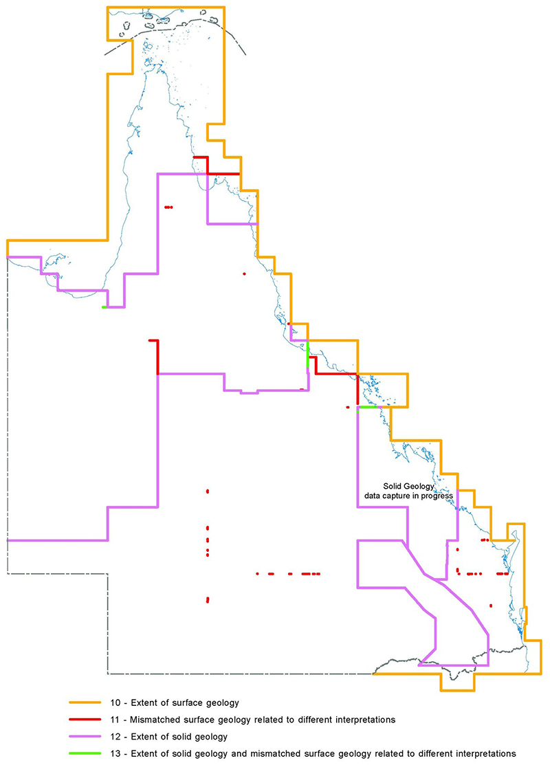
Figure 2 - Revised and new geology updates